
Indonesia deploys aerial firefighting in West Papua as nationwide fire crisis intensifies
The National Disaster Management Agency has conducted 69 water-bombing drops in Teluk Bintuni Regency as part of a nationwide response to record-breaking fire activity driven by strong El Niño conditions.
Indonesia deploys aerial firefighting in West Papua as nationwide fire crisis intensifies
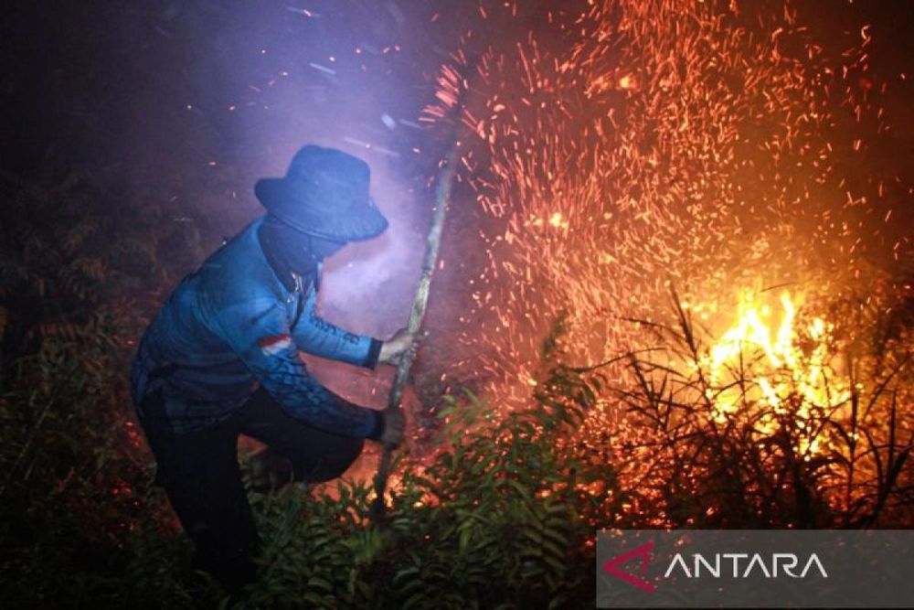
Indonesia's National Disaster Management Agency (BNPB) has escalated firefighting operations in West Papua Province, deploying a specialized water-bombing helicopter that has completed 69 aerial drops across fire-affected areas in Teluk Bintuni Regency as the nation confronts one of its most severe fire seasons on record.
The agency, which was established in 2008 and reports directly to the President of Indonesia, confirmed that the PK-DBM helicopter carried out two sorties on Friday, August 28. Acting Head of BNPB's Disaster Data, Information and Communication Center Berton SP Panjaitan said the first mission targeted Cluster 3, where 26 water drops released approximately 26,000 liters over four hectares of burning land. The second sortie focused on Cluster 1, discharging around 28,000 liters through 28 drops across three hectares.
While active flames have been extinguished at both locations, thin plumes of smoke continue to rise from the sites. Residual heat trapped beneath vegetation cover requires ongoing monitoring to prevent reignition, Berton noted. The three sorties conducted in Teluk Bintuni have cumulatively delivered 69,000 liters of water to affected areas.
Geographic and climatic challenges compound firefighting efforts
Teluk Bintuni Regency, located on the Bird's Head Peninsula between the southern coast and the Onin Peninsula overlooking the Seram Sea, presents significant operational challenges for aerial firefighting. The regency, established in November 2002, features mountainous terrain that complicates access and response efforts.
Berton emphasized that firefighting strategies across West Papua must account for local geography and conditions. Beyond Teluk Bintuni, active fires have been detected in Fakfak Regency, South Manokwari, and the Arfak Mountains.
Technical considerations are crucial, especially in mountainous areas and hard-to-reach fire locations,he explained, noting that helicopter deployments depend on aircraft range, proximity to operational bases, availability of local water sources, and terrain safety.
Satellite monitoring systems operated by NASA's Terra, Aqua, SNPP, and NOAA-20 platforms detected 36 active hotspots across West Papua Province, including four flagged with high confidence levels. By late August, the province recorded 468 fire hotspots, positioning it among the most affected regions alongside East Kalimantan with 576 hotspots and Riau with 503.
Record fire season threatens to worsen
The West Papua operations are part of a broader national emergency response to unprecedented fire activity in 2026. By late July, Indonesia had recorded more than 96,000 fire hotspots, surpassing the devastating 2019 fire season which saw 88,000 hotspots by the same point, and far exceeding the 58,000 recorded in 2023. Approximately 103,000 hectares burned nationwide during the first half of 2026 alone.
Indonesia's Meteorology, Climatology and Geophysics Agency (BMKG) has warned that a strong El Niño pattern is driving the crisis. By mid-July, nearly 93% of Indonesia had recorded low rainfall, while almost 73% of the country's seasonal climate zones had entered the dry season. West Papua itself experienced a devastating fire peak in 2015 when El Niño conditions contributed to 44,000 hectares burning, particularly in Fakfak, Kaimana, and Sorong Selatan regencies.
The current situation may deteriorate further, as Indonesia's forest fires typically intensify in August before reaching their peak in September and October during the dry season. Historical precedent underscores the gravity of the threat: the 2015 Indonesian fire season burned approximately 2.6 million hectares and released more carbon dioxide daily than the entire United States economy, spreading hazardous haze across Singapore, Malaysia and neighboring countries.
Nationwide aerial operations expand
According to data from the Ministry of Forestry's SIPONGI monitoring platform, burned areas in West Papua had reached nearly 2,500 hectares as of Thursday, August 27. BNPB has deployed aerial firefighting resources across multiple provinces, with 4.6 million liters of water used in operations spanning West Kalimantan, Central Kalimantan, South Kalimantan, South Sumatra, Jambi, and Riau as of late August.
BNPB and the Regional Disaster Management Agency (BPBD) continue conducting joint monitoring efforts to protect local communities and contain the spread of fires across affected regions.